About Locus GIS offline land survey
Professional GIS application for offline fieldwork with geodata. It provides data collection, viewing, and updating. All its features are available above a wide selection of online, offline, and WMS maps. Fieldwork • offl
Professional GIS application for offline fieldwork with geodata. It provides data collection, viewing, and updating. All its features are available above a wide selection of online, offline, and WMS maps.
Fieldwork
• offline collecting and updating of field data
• saving points with current or arbitrary position
• creating lines and polygons by motion recording
• settings of attributes
• photos, video/audio or drawings as attachments
• guidance to points
• collecting location data for polygon/line recording or guidance on a target, even when the app is running in the background
Import/Export
• importing and editing ESRI SHP files
• exporting data to ESRI SHP or CSV files
• exporting whole projects to QGIS
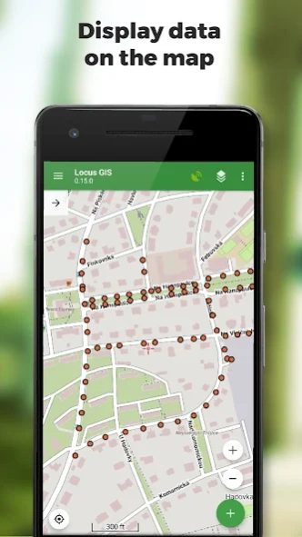
Maps
• wide range of maps both for online use and for download
• support of WMS sources
• support of offline maps in MBTiles, SQLite, MapsForge, TAR, GEMF, RMAP formats, and custom OpenStreetMap data or map themes
Tools and features
• measuring distances and areas
• searching and filtering of data in the attribute table
• style editing and text labels
• organizing data into layers and projects
Locus GIS is successfully used in a wide range of industries:
• collection of environmental data (ecological scanning, tree surveys ...)
• forestry management and planning,
• agriculture and soil management
• gas and energy distribution
• planning and construction of wind farms
• exploration of mining fields and location of wells
• survey and management of urban facilities
• road constructions and maintenance
Previous Versions
Here you can find the changelog of Locus GIS offline land survey since it was posted on our website on 2016-12-27 11:15:38.
The latest version is 1.22.2 and it was updated on 2024-04-22 12:40:16. See below the changes in each version.
Locus GIS offline land survey version 1.22.2
Updated At: 2024-03-27
Changes: *** 1.22.2 ***
- add: a brand-new manager for GNSS external devices
- add: NTRIP client (currently in beta testing)
- add: ability to choose multiple options for enumeration attributes
- add: a completely new system for managing accuracy tolerances and warnings
- add: edit the starting number in the auto-numbering sequence
- add: option to add several independent WMS layers from a single WMS service
Locus GIS offline land survey version 1.21.5
Updated At: 2024-03-17
Changes: *** 1.21.5 ***
- fix: defunct metric units for the layer style
Locus GIS offline land survey version 1.21.4
Updated At: 2024-01-31
Changes: *** 1.21.4 ***
- add: option to add multiple independent WMS layers from one WMS service
- add: Automatic resize of photo attachments. See Settings > Miscellaneous
- chg: Improved start of application
- fix: Defunct creating of new points during recording a new line or polygon by movement
- fix: Defunct import of older project templates
- fix: Style settings screen not working on some tablets
- fix: unwanted export of deleted attributes to the template
Locus GIS offline land survey version 1.20.0
Updated At: 2023-11-25
Changes: - add: exported SHP can be imported 1:1. Attributes types, attachment or style are preserved during import
- add: possibility to rename a WMS service
- add: more possibilities to convert attributes data types (enumeration from numeric values, etc.)
- fix: problems with duplicated attribute named GEOMETRY
- fix: capitalization of enumeration values when converting the type of attribute
- fix: problem with refresh of the online map after clearing the cache
Locus GIS offline land survey version 1.19.3
Updated At: 2023-01-30
Changes: - chg: option to set 'Not specified' value as the default for an enumeration attribute
- fix: defunct change of a text attribute type to enumeration
Locus GIS offline land survey version 1.16.0
Updated At: 2022-04-19
Changes: *** 1.16.0 ***
- add: OneDrive cloud file hosting
- add: option of automatic fix of invalid polygons
- add: export of SHP and CSV with attachments
- chg: organizing of default paths for SHP, CSV export
- chg: copying of coordinates from top panel in displayed format
- chg: multiline text field when editing a long attribute value
- fix: defunct export of points into KML
- fix: defunct ordering of KML layer
- fix: opening of previous project
Locus GIS offline land survey version 1.15.0
Updated At: 2022-02-18
Changes: *** 1.15.0 ***
- add: Croatian translation
- add: support for EPSG 7393
- add: support for project coordinates in "GPS Averaging" feature
- add: support for "Get feature info" for WMS maps
- chg: increased maximum map zoom
- chg: update definition of CRS Amersfoort, EPSG: 28992
- chg: automatically enabled external GNSS when added to sensors manager
- chg: improved KML/KMZ export for lines/polygons
- fix: export CSV not properly quoted
- fix: map layers can't be turned on/off
Locus GIS offline land survey version 1.14.1
Updated At: 2021-10-26
Changes: *** 1.14.1 ***
- chg: unified map selection when adding a new map layer
- fix: defunct export to SHP - error 20006
- fix: defunct Bluetooth Sensors manager - error 10706
- fix: app stopped responding when GPS status screen was displayed
Locus GIS offline land survey version 1.14.0
Updated At: 2021-10-10
Changes: *** 1.14.0 ***
- add: feature properties attribute type including accuracy, length, area and coordinates
- add: new Bluetooth GNSS manager
- add: support for USB GNSS units
- chg: displayed GPX file update at app start
- chg: higher priority for Position averaging
- fix: not working SQLite maps with other-than-256px tiles
- fix: improved import of SHP with attribute table containing invalid data
- fix: defunct back button in Locus Store history system
Locus GIS offline land survey version 1.13.0
Updated At: 2021-10-10
Changes: *** 1.13.0 ***
- add: support for WMTS services
- add: download of offline DEM data (for terrain shading, displaying elevation on cursor position... )
- add: manual map rotation
- add: export project as template, create a project from a template
- fix: feature deleted during editing feature attributes or feature attachment
- fix: project icon turning black
Disclaimer
Official Google Play Link
We do not host Locus GIS offline land survey on our servers. We did not scan it for viruses, adware, spyware or other type of malware. This app is hosted by Google and passed their terms and conditions to be listed there. We recommend caution when installing it.
The Google Play link for Locus GIS offline land survey is provided to you by apps112.com without any warranties, representations or guarantees of any kind, so access it at your own risk.
If you have questions regarding this particular app contact the publisher directly. For questions about the functionalities of apps112.com contact us.